Q1: I need one industrial inspection drone for mapping, thermal checks and emergency work. Is a mid-size expandable platform the right starting point?
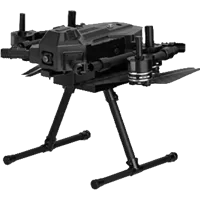
A1: The UIE900 is designed as a configurable industrial platform rather than a camera-specific package. Its 2.1 kg payload capacity, front and rear expansion positions, RTK option and software compatibility can suit mixed missions when the chosen payloads, mounts and operating approvals are defined first.
Q2: Our engineering team has a 1.8-kilogram sensor package. Can an industrial inspection drone carry it together with the mount and wiring?
A2: The UIE900 page lists a payload capacity of 2.1 kg and a maximum takeoff weight of 10.5 kg. Count the sensor, mount, cables, adapters and any second payload in the installed mass, then verify balance, power demand and interface compatibility before flight.
Q3: When an inspection drone carries its full working payload, how much flight time should our project schedule actually assume?
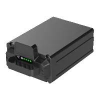
A3: The UIE900 specification lists approximately 43 minutes with full payload and 55 minutes in hover without load using the 17 Ah smart battery. Route speed, wind, temperature, battery age, reserve policy and payload power draw will reduce or change real mission time.
Q4: We inspect forest roads and power lines. Does this industrial inspection drone avoid obstacles in every direction or only ahead?
A4: The UIE900 specification describes forward-facing LiDAR obstacle avoidance with a 0.1–12 m range and an 8 m/s avoidance speed. Do not treat that as omnidirectional protection; route planning, stand-off distance, lighting and pilot observation remain necessary around side and rear hazards.
Q5: For repeatable construction surveys, can an industrial inspection drone use centimeter-level positioning and standard ground-control software?
A5: The UIE900 page lists dual-antenna RTK positioning and support for UniGCS, Mission Planner and QGroundControl. Confirm the exact flight controller build, correction source, coordinate workflow and mapping payload, then validate accuracy with ground control rather than relying on the RTK label alone.
Q6: Our power utility wants thermal fault checks after sunset. Which inspection drone payload and lighting arrangement should be quoted?
A6: The UIE900 is shown with the UniPod MT11 mini multi-sensor gimbal and an optional searchlight for thermal and night patrol work. Confirm the current camera specification, thermal measurement requirements, light power, mount, software license and total payload in the written quotation.
Q7: A surveying company already owns a mapping camera. What must be checked before mounting it on a new industrial inspection drone?
A7: The UIE900 provides a standard gimbal mechanical interface and second-generation expansion interfaces, but third-party fit is not automatic. Verify mass, center of gravity, voltage, data protocol, trigger timing, vibration isolation, geotagging and ground-station support through a documented integration test.
Q8: At a busy intersection, can an inspection drone recognize license plates and send voice alerts without separate aircraft?
A8: The UIE900 product page presents a traffic configuration using an AI module, compatible gimbal and loudspeaker for license-plate recognition and alerts. Recognition distance, jurisdiction, privacy rules, payload selection and the exact algorithm license must be confirmed before promising that workflow.
Q9: During disaster response we may need to carry a radio or medical pack. How much can this inspection drone deliver safely?
A9: The UIE900 lists up to 2.1 kg of payload capacity, but that maximum includes the complete delivery mechanism and any camera or communication equipment. Actual safe delivery mass depends on route, altitude, wind, reserve energy and the approved release system.
Q10: If our inspection drone must watch a site for hours, can it be connected to a tether instead of cycling batteries?
A10: The UIE900 product page describes tethered monitoring as a supported application, but the tether system is not defined as part of the standard aircraft package. Obtain the compatible ground power unit, airborne module, cable limit, operating envelope and emergency release procedure before planning continuous flight.
Q11: My company builds custom gas sensors. Does the industrial inspection drone provide enough interfaces for a third-party payload project?
A11: The UIE900 lists a standard gimbal interface, front and rear expansion positions and second-generation data interfaces. The public page does not define every electrical or software detail, so request pinouts, power budgets, protocols and an SDK or integration kit before engineering the gas-sensor payload.
Q12: Our pilots already use Mission Planner and QGroundControl. Can the same workflow control this industrial inspection drone?
A12: The UIE900 page lists Mission Planner and QGroundControl compatibility along with UniGCS. Confirm which functions, video codecs, payload controls and firmware versions are supported in each application, because basic flight planning does not guarantee full camera or AI integration.
Q13: Before bidding a remote pipeline job, how should we read the long communication range claimed for this industrial inspection drone?
A13: The UIE900 controller specification lists up to 35 km with no interference or obstruction and shorter 10–15 km figures in a rural interference example. Those are radio benchmarks, not legal mission radii; terrain, antennas, region, airspace rules and aircraft endurance control the usable route.
Q14: Our ridge-top wind is unpredictable. What published wind resistance should an industrial inspection drone operator use for planning?
A14: The UIE900 aircraft specification lists wind resistance of 11.5 m/s. Plan below the maximum after considering gust spread, turbulence near structures, payload area, return route and takeoff or landing conditions; the published figure is not a universal launch threshold.
Q15: The industrial inspection drone is marked IPX4. Does that mean our crews can keep flying through steady rain?
A15: No. The UIE900 aircraft specification lists IPX4, which describes a defined splash-protection test and is not an all-weather flight guarantee. Follow the manufacturer's weather limits, protect connectors and payloads, and stop when rain, visibility, wind or electrical risk exceeds the operating procedure.
Q16: A mine sits high above sea level. Is the maximum altitude figure for this inspection drone the same as legal operating height?
A16: The UIE900 specification lists a maximum flight altitude of 5,000 m, which is an equipment capability figure. It does not override local height limits, density-altitude effects, reduced payload or endurance, battery temperature, airspace permission or safe emergency landing requirements.
Q17: Two people must carry the inspection drone between sites. What folded size and transport case are listed for the aircraft?
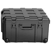
A17: The UIE900 is listed at about 428 × 412 × 425 mm folded with propellers and uses foldable arms plus quick-release landing gear. The package references an IP67 explosion-proof safety case; confirm loaded case dimensions and weight with batteries, payloads and charger.
Q18: What normally arrives with the industrial inspection drone, and which cameras or accessories should procurement treat as optional?
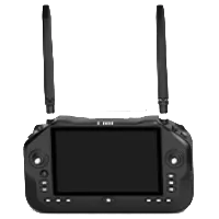
A18: The UIE900 page lists the complete aircraft, one remote controller, one standard battery and one carrying case by default. Cameras, loudspeakers, lights, tether equipment, mounts and other payloads depend on the selected configuration, so the signed quotation must be the final bill of materials.
Q19: In direct sunlight our pilot needs a readable screen all day. What controller endurance is published for this industrial inspection drone?
A19: The UIE900 controller lists a 7-inch 1,600-nit touchscreen, a 13,400 mAh battery and approximately eight hours of endurance. Screen brightness, radio use, temperature and external devices affect runtime, and the listed charging time is about 4.5 hours with PD 30 W.
Q20: When an inspection drone approaches restricted airspace, will geofencing alone keep our operation legally compliant?
A20: The UIE900 page describes geofencing alerts and return or landing options near restricted areas. Geofencing is a support feature, not legal authorization or a complete airspace database; the operator must still check current notices, permissions, local maps and mission-specific restrictions.
Q21: For automated defect detection, what kind of onboard AI can this industrial inspection drone support before sending data to the office?
A21: The UIE900 page lists an AI tracking module rated at 10 TOPS at INT8 and examples including people, license plates and insulators. Confirm the current module, supported models, training data, accuracy criteria, compute load and licensing for the specific defect-detection task.
Q22: We operate a fleet of inspection drones and cannot wait for batteries to cool unpredictably. What battery rotation data should we collect?
A22: For the UIE900, track battery temperature, cycles, internal resistance, charge time, mission load, landing reserve and storage history for each 17 Ah pack. The page gives endurance figures but not a complete fleet rotation rule, so size inventory from actual mission and cooling tests.
Q23: After dusty construction work, which parts of an industrial inspection drone need the most attention before the next deployment?
A23: For the UIE900, inspect folding arms, quick-release landing gear, 22-inch propellers, motors, LiDAR window, FPV camera, payload mounts, connectors, battery contacts and case. Follow the official maintenance schedule and trained-service guidance rather than opening protected components in the field.
Q24: A public-safety tender needs one inspection drone for traffic, search and mapping. Which acceptance tests should be written into the contract?
A24: For the UIE900, test the exact payloads, loaded endurance, RTK workflow, forward LiDAR limits, radio link, AI functions, data export, controller visibility, folding deployment and fail-safe behavior. Include training, spares, documentation, software versions and local regulatory acceptance as separate deliverables.
Q25: The leasing company wants a business case for an expandable inspection drone. Which operating costs should not be left out?
A25: A UIE900 ownership model should include each payload and mount, batteries, charging, controller, software, connectivity, training, permissions, insurance, transport, maintenance, spare parts, repairs and downtime. Multi-mission flexibility can improve utilization, but it does not guarantee revenue or payback.